Introducing road level details in the Maps Javascript API, Maps SDKs, and Navigation SDKs

Navigating roads, intersections, and pathways just got easier. We’re excited to introduce visual road level details across the Maps JavaScript API, Maps SDKs, and Navigation SDKs. These enhancements provide you with highly detailed road information to help your users—whether they’re drivers, cyclists, or pedestrians—understand their environment better and navigate with confidence.
Bringing greater visual detail to the road map style
Road level details are now generally available in select major cities throughout North and South America, Europe and Asia. These enhancements include:
Sidewalks and crosswalks for improved walkability
Accurately scaled road widths, centerlines, and medians for better visualization
Lane markings and special-use lanes (e.g. bike lanes, HOV lanes, parking lanes, right-turn-only lanes)
Pathways and stairs in parks
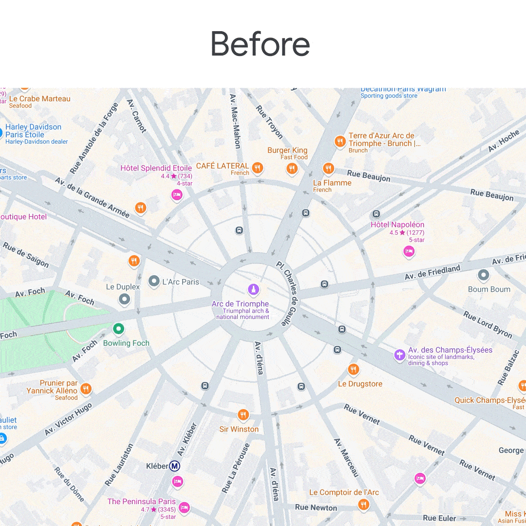
Paris street details
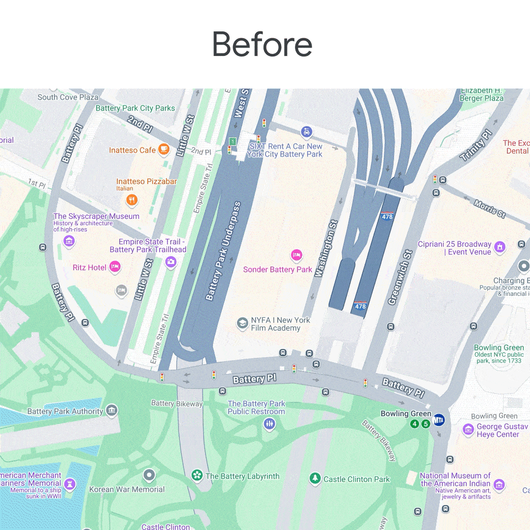
New York City details
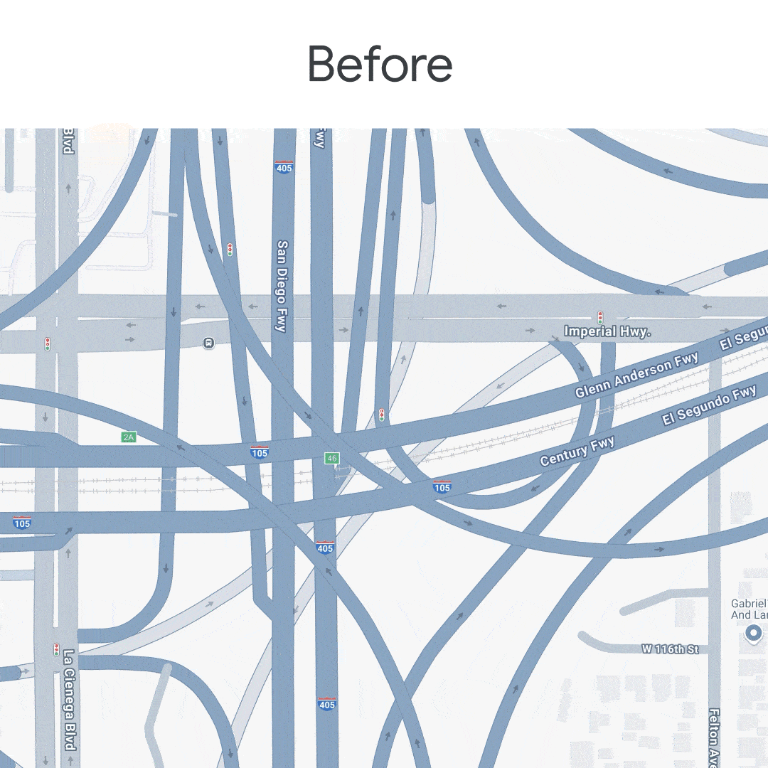
Los Angeles freeway details
Previously, these road details were only available in the Google Maps consumer web and mobile experiences. Now, we’re excited to make this high fidelity road information available to all our developers across Google Maps Platform.
Get road level details with Cloud-based map styling
You can quickly and easily use Cloud-based map styling to customize road details visual elements in your custom map style for both web and mobile applications. Developers using customized map styles should update their configurations for zoom levels 17+ using Cloud-based map styling or JSON styling. If your map relies on road geometry for markers, overlays, or features, we recommend testing with a recent SDK/API version to ensure visual compatibility. Notable changes include:
Roads now appear as polygons rather than polylines for improved accuracy
High-level road types (e.g. highway, local road) no longer apply at these zoom levels
Crosswalks and intersection signage can now be custom-styled via Cloud-based map styling

Leverage Cloud-based map styling to preview road level details for custom styles.
Enhancing navigation experiences
If you use the Navigation SDK, road level details bring even more precision to in-app navigation. Your users will benefit from:
Clearer lane visibility to better anticipate merges, forks, and exits
Detailed crosswalk visuals for improved pedestrian navigation
Enhanced lane markings
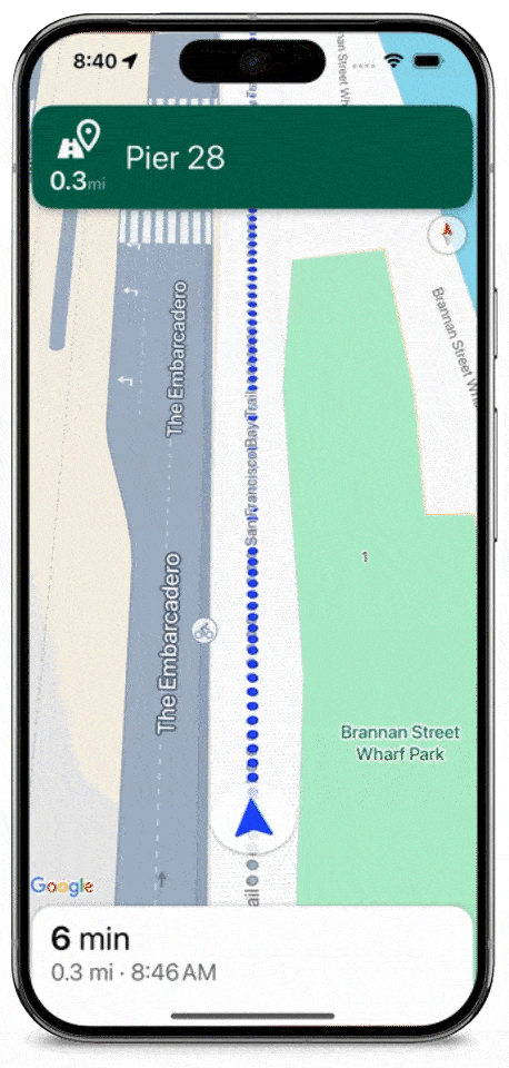
Walking navigation with road level details
What’s changing for developers?
These updates will be automatically integrated into your basemap styles across Maps and Navigation SDKs using the roadmap style. This applies to the Maps JavaScript API, Static API, Maps Embed API, Map Tiles API, Android and iOS Maps SDKs, and Android and iOS Navigation SDKs.
If you are already using the latest versions of these APIs and SDKs, you’ll start seeing road level details without additional changes. If you are using Industry Optimized Map Styling, our new road level details enhancements replaces Industry Optimized Map Styling and provides even higher fidelity details for your basemap.
Get started today
To take advantage of road level details, update to the latest version of Maps JavaScript API, Maps SDKs, and Navigation SDKs. To learn more, check out our developer documentation.
Ju Tan, Product Manager, Google Maps Platform and Tingting Li , Product Manager, Google Maps Platform also contributed to this article.

