
We are excited to announce the launch of Google Maps Platform’s Architecture Center! The Architecture Center is a central resource for product managers, architects, and technical leads who are looking to design a location-based application or accelerate the integration of Google Maps Platform into their products or infrastructure.
We’ve learned from customers that there is a growing need for content that demonstrates and describes using Google Maps Platform with other technologies. That can mean bringing together multiple Google Maps Platform technologies to satisfy a business use case or integrating with GCP and 3rd party technologies and frameworks.
Architecture Center content focuses on using Google Maps Platform to deliver customer value by solving real business problems. It places a special emphasis on business use cases and how to enable those use cases quickly and efficiently using a variety of technology and techniques. With the Architecture Center you will:
-
Learn about real-world examples of how Google Maps Platform is being used to build innovative applications.
-
Explore reference architectures for common location-based application patterns.
-
Learn about best practices for designing and developing location-based applications.
-
Get help with planning, implementing, and testing your location-based applications.
A great example of a reference architecture we are releasing is: See your data in real time with data driven styling:
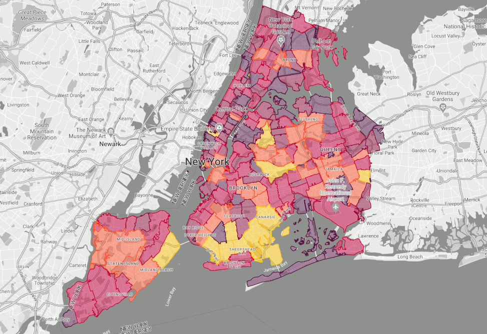
Animated taxi counts in New York City by postal code boundary (simulated, time-lapsed) visualized using Data Driven Styling.
This use case guide describes why and how to implement dynamic Data-driven styling of Google Boundaries using the Maps Javascript API, which is useful for a variety of use cases across industries and segments.
The new Architecture Center is a valuable resource for anyone who wants to build location-based applications. To learn more, visit the Architecture Center today.
We are excited to release the following content at launch:
Engage Customers with Aerial View
Engage Customers in Real Time with Advanced Markers & Firebase
Measuring the impact of Address Validation using an A/B test
Address Validation for Ecommerce Checkout
Enhance the accuracy of Address input for Aerial View
We hope you find the Architecture Center useful. Please feel free to submit feedback via the feedback buttons in the Architecture Center.
For more information on Google Maps Platform, visit our website.

