Today, we’re excited to announce that 3D Maps is now Generally Available—empowering businesses to bring locations to life with immersive, photorealistic 3D experiences across web and mobile web experiences.
As a production-ready solution, 3D Maps easily helps businesses meet the rising demand for realistic, interactive experiences. With photorealistic environments and powerful customization, 3D Maps enables you to bring locations to life to engage users, drive informed purchase decisions, and differentiate your brand through immersive storytelling.
Unlock immersive route planning experiences
3D Maps make real-world exploration more dynamic and engaging for athletes, spectators, and event organizers alike. For example, RunConcierge combines 3D Maps with Grounding with Google Maps in Vertex AI to create immersive “experience maps” for runners and spectators at marathons and other sporting events. Together, Tata Consultancy Services (TCS) and Neurun are leveraging this technology to elevate the race week experience for the TCS New York City Marathon, one of the world’s largest running events. Runners and fans can virtually preview the course and terrain, discover local race resources, and get myriad questions about the event answered instantly. With RunConcierge, event organizers can take advantage of the chat agent to have the most up to date race information available, helping participants and spectators navigate race day with confidence and ease.
Using RunConcierge spectators and runners can explore the TCS New York City Marathon route through AI prompts and an immersive 3D map.
“Marathons are fundamentally human powered, which makes the TCS New York City Marathon an ideal living lab to showcase the power of 3D maps and AI to improve our user experiences. Innovations like RunConcierge point to a future where AI and immersive maps guide us at every turn.” — Michelle Taylor, Global Head, Sports Sponsorships, TCS
Accelerate real-estate discovery and buyer confidence
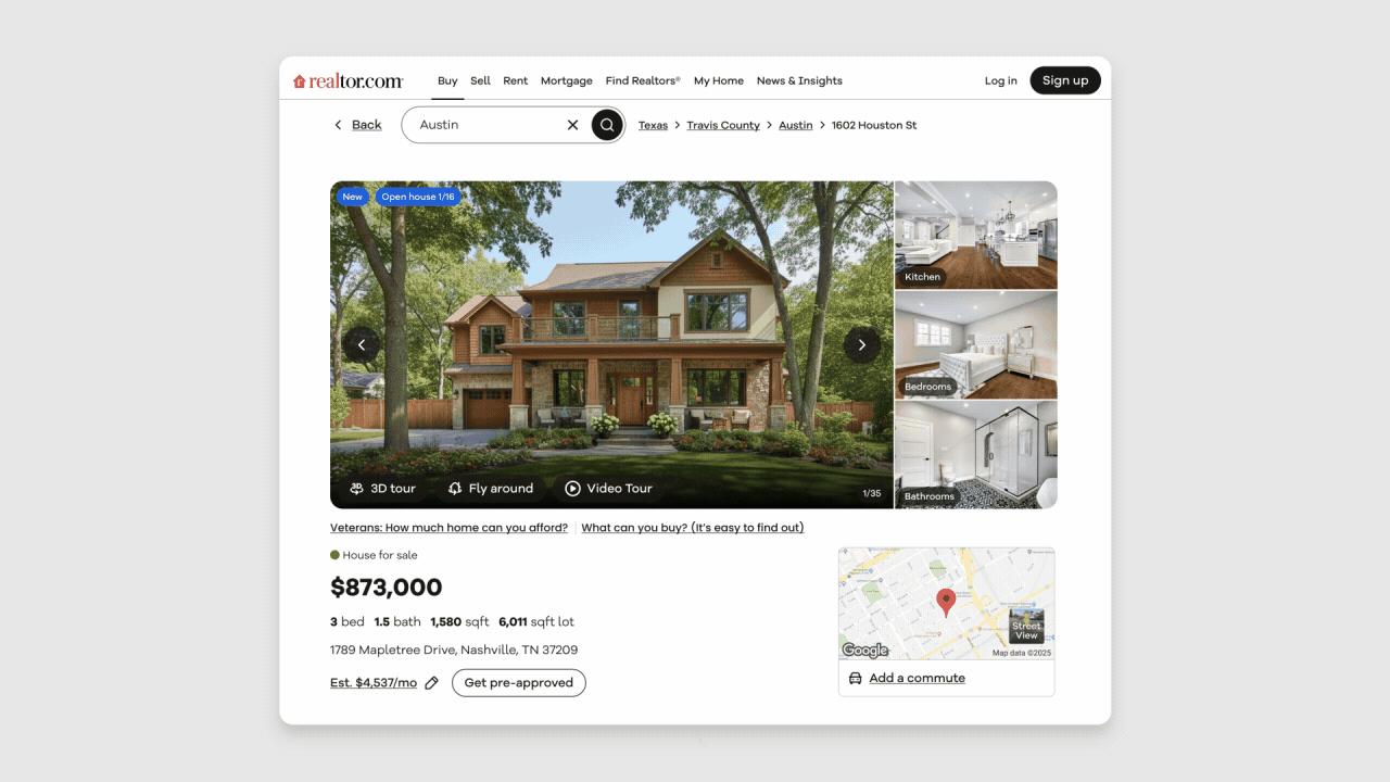
3D Maps enables real estate platforms to drive quality conversions by letting users explore a home’s neighborhood.
Realtor.com uses 3D Maps to let homebuyers ‘fly around’ and explore a neighborhood. By visualizing everything from parks and playgrounds to local restaurants and coffee shops in a realistic 3D environment, Realtor.com helps homebuyers get a feel for the area, leading to more confident bookings.
According to Realtor.com®’s 2025 Consumer Attitudes & Usage Study, half of buyers who purchased or tried to purchase a home in the past year said they would consider buying a home without seeing it in person, up from 44% in 2023. Among first-time homebuyers, that number rises to 52%. FlyAround is designed to meet these evolving consumer expectations by providing a new level of information and clarity in online home search.
With Realtor.com's new FlyAround feature, home shoppers can move beyond the limitations of static photos and maps to see properties in full context—lot dimensions, topography, and how a home fits into its surrounding neighborhood.
“Realtor.com has always been a market leader when it comes to building deeply engaging end-user experiences. We believe the future of real estate is immersive: where buyers and renters discover and explore homes, neighborhoods and even cities right from the comfort of their homes. With 3D Maps from Google Maps Platform, we are empowering our customers to make more informed, confident and faster decisions by letting them ‘feel’ a neighborhood much earlier in the buying/renting process. We are excited about the potential to define this new era of real estate user experience with Google.” — Dave Herman, SVP of Product and AI innovation, Realtor.com
Drive destination discovery, trip planning and faster bookings
Whether booking a trip, choosing a hotel, or buying a home, users want to understand places in context. 3D Maps allows businesses to show neighborhoods, destinations, and routes with a level of realism that helps customers feel more confident in their decisions.
Localyse created a comprehensive travel app with 3D Maps that allows customers to explore destinations remotely before booking. They can preview immersive 3D guided tours for any journey, whether cycling, hiking, or driving—before they ever set foot on the path. By integrating with the Gemini API, the app intelligently selects optimal stops and provides rich contextual information, while the Places UI Kit delivers a seamless interface for detailed place insights. This powerful combination, along with Compute Routes for dynamic walking route optimization, creates a smarter and more interactive user experience.

Roamly allows users to explore destinations remotely before booking. They can preview immersive 3D guided tours for any journey, whether cycling, hiking, or driving—before they ever set foot on the path.
“I was amazed at how easily I could build something that felt cinematic and intuitive when I started experimenting with 3D Maps in JavaScript. It’s one thing to show locations on a map, it’s another to let users feel the place through dynamic perspectives. It also bridges the gap between data and experience. It makes maps more visual and engaging. Whether you’re exploring a city, planning a trip, or just trying to understand your surroundings.” — Eline Van Straaten, Customer Engineer, Localyse
Ubilabs helped fans explore stadiums through virtual visit and interactive routes from transit to the entrance for the 2024 European Football Championship. Fans were able to explore every detail of the stadiums in stunning 3D, providing a more immersive, interactive user experience.

Ubilabs' 3D Maps elevate the fan experience by seamlessly guiding users, with custom route information showing the most efficient path from the train station right to their exact seat in the stadium.
“3D increases the engagement at sports events because it is shifting the experience from passive viewing to active participation. People can interact with the scene instead of just sitting around. 3D live tracking is the only way for the vast majority of fans to follow the action in real time, making the event more marketable and accessible globally.” — Martin Kleppe, CTO Ubilabs
Create brand engagement through immersive storytelling
In a crowded digital landscape, immersive experiences are a powerful way to stand out. 3D Maps gives marketers and brands the tools to create memorable, engaging campaigns that build loyalty and drive return visits.
Modern English, a UK-based agency, recently partnered with Orijen Dog Foods to launch an interactive campaign that brought dog-friendly hiking routes across the U.S. to life in 3D. Dog owners can explore trails with their pets, transforming a simple campaign into a highly engaging, repeatable experience that keeps customers coming back while building brand loyalty.

Orijen Dog Foods and Modern English leverage the personalization and immersion of 3D Maps to create a full-journey experience—from filtering trails by pet size and activity preferences to an immersive 3D trail view and post-hike activity summary—that keeps customers coming back.
What’s new in this release
The General Availability of 3D Maps in the Maps JavaScript API includes powerful new features that give developers the control to create production-ready and intuitive 3D map experiences:
Cloud-based map styling (now in Preview for 3D Maps): This highly requested feature gives you control over styling your basemap, with over 100 styleable map elements, including POI filtering and density, and road styling to create custom, branded and differentiated 3D map experiences. Existing Maps customers using Cloud-based map styling can re-use the same map style right away for 3D Maps. Combined with existing features like custom markers, interactive popovers, and styled polylines—these new styling options provide the most flexible canvas yet to build powerful immersive experiences.

3D Maps lets you easily customize POI filtering and road styling. As seen in this Seattle example, tourist attractions are highlighted to the user and the street styling has been changed to represent the City of Seattle’s flag color.
Improved accessibility: Basemap POIs are now fully interactive for users navigating with keyboards and screen readers.
Cooperative gesture handling: This feature prevents unwanted map movement when users are scrolling a web page, creating a smoother and more intuitive user experience.
Enhanced usability: Alongside these core updates, we’ve introduced features like lazy loading, simplified UI design, and better localization choices to improve the user experience and performance.
More customization options: We’ve also introduced web components for polylines, polygons, and markers with custom pins, giving you more ways to customize map elements using HTML.
Ready to get started?
Start building your own immersive maps experience with 3D Maps in Maps JavaScript API. Here are resources to get you started:
Explore the documentation for the full range of features and customization options.
Work through code samples and interactive code labs that guide you from your first 3D map to adding custom features and interactivity.
Try out the live demo to see 3D Maps in action.
Review the pricing information for the Immersive Maps SKU, and use the pricing calculator to help plan your implementation.
Bring your locations to life with immersive, real-world 3D Maps—and start building the next generation of engaging, interactive experiences today.

