Products
Product availability, functionality and terms may differ for customers with billing addresses in the European Economic Area (EEA). Learn more
Solutions
By industry
By use case
Products
Product availability, functionality and terms may differ for customers with billing addresses in the European Economic Area (EEA). Learn more
Solutions
By industry
By use case
Products
Product availability, functionality and terms may differ for customers with billing addresses in the European Economic Area (EEA). Learn more
Solutions
By industry
By use case
Use cases
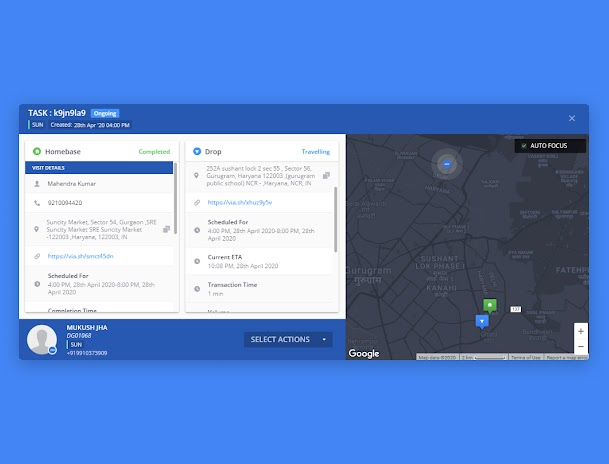
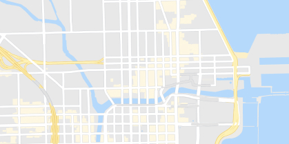
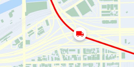
Enable asset tracking
Dynamically track and visualize moving assets. If you manage a large fleet, contact sales

Track assets
Show dynamic updates
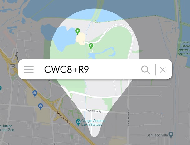
Locate without addresses


Products built for asset tracking
Dynamic Maps
Customize and style interactive maps using Cloud-based maps styling for real time updates across all devices and platforms.
Learn more

Dynamic Street View
Embed real-world imagery with 360° panoramas.
Elevation
Provide a simple interface to query locations on the earth for elevation data.
Static Maps
Embed simple map images on your website with minimal code.
Static Street View
Embed a static (non-interactive) Street View panorama or thumbnail into your web page, without the use of JavaScript.
Roads
Determine the route a vehicle travels.
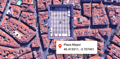
Geocoding
Convert addresses to geographic coordinates or the reverse.
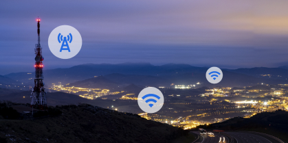
Geolocation
Return the location of a device without relying on GPS, using geospatial data from cell towers and WiFi nodes.
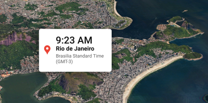
Time Zone
Get the time zone for a specific latitude and longitude coordinate.


Google Maps Platform helped Fleetminder create a unique web-based dashboard and system that keeps the company on the cutting edge of its industry and makes it stand out in the highly competitive asset-tracking, fleet management market.
Mohit Khanna
CIO and Co-founder, Fleetminder


-
*Free usage refers to monthly calls available at no cost. Essentials Map Tiles APIs provide up to 100,000 calls at no cost per SKU per month.
-
Product availability, functionality and terms may differ for customers with billing addresses in the European Economic Area (EEA). Learn more